SUNSET2 - Near Space Balloon
SUNSET2 was launched and recovered successfully a few weeks ago. This was my second attempt at a Propeller powered near-space balloon. You can read about the partially successful first attempt here:
http://forums.parallax.com/showthread.php?136334-Parallax-Propeller-Near-Space-Balloon&highlight=SSTV
This time the payload contained the following (all housed in a styrofoam 6pack coolerbox):
This time the flight was a success! The payload was launched using a 350g balloon from the Cape Town International Airport with the help of the Weather Office. The balloon was tracked and recovered about 200km away in Robertson on a farm. To get there it flew over a fairly large mountain range, making the chase quite difficult! The backup tracker's signal was picked up by the local APRS network and forwarded to aprs.fi for the duration of the flight. The Propeller board's signals were picked up by a UHF mag mount omni antenna on the roof of our tracking vehicle. Unfortunately the Propeller's GPS had trouble maintaining lock throughout the flight. I'm not sure why this was the case. However, beautiful SSTV images were received throughout the flight! I was amazed at how well this worked using only 100mW!
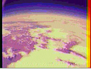
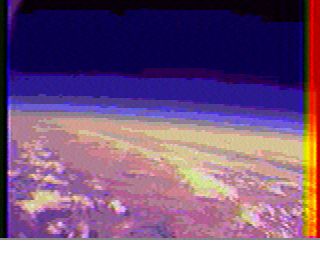
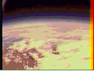
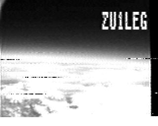
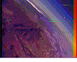
Unfortunately the GoPro camera fogged up inside its waterproof enclosure, leading to blurry video. But overall, it was a great success! I will definitely be including the live SSTV feature in all future flights!
If anyone is interested in any of the code, let me know, and I will post it here.
Thanks for the read!
http://forums.parallax.com/showthread.php?136334-Parallax-Propeller-Near-Space-Balloon&highlight=SSTV
This time the payload contained the following (all housed in a styrofoam 6pack coolerbox):
- My custom parallax propeller powered flight computer (more below)
- A backup 5W 2m APRS tracker (SkyTracker) powered by 6 Energizer Lithium AAs
- A GoPro camera with extended battery in its waterproof enclosure
- An RF beacon for direction finding, usually used for hobby rockets
- Inside and outside temperature measurements using Maxim DS1822 sensors
- Transmit GPS and temperature data in APRS packets
- Take 120x160 colour and BW images once a minute using a uCAM and transmit these to the ground using SSTV
This time the flight was a success! The payload was launched using a 350g balloon from the Cape Town International Airport with the help of the Weather Office. The balloon was tracked and recovered about 200km away in Robertson on a farm. To get there it flew over a fairly large mountain range, making the chase quite difficult! The backup tracker's signal was picked up by the local APRS network and forwarded to aprs.fi for the duration of the flight. The Propeller board's signals were picked up by a UHF mag mount omni antenna on the roof of our tracking vehicle. Unfortunately the Propeller's GPS had trouble maintaining lock throughout the flight. I'm not sure why this was the case. However, beautiful SSTV images were received throughout the flight! I was amazed at how well this worked using only 100mW!


Unfortunately the GoPro camera fogged up inside its waterproof enclosure, leading to blurry video. But overall, it was a great success! I will definitely be including the live SSTV feature in all future flights!
If anyone is interested in any of the code, let me know, and I will post it here.
Thanks for the read!


Comments
What altitudes did you reach on this flight?
I wonder if GoPro would/could offer any technical advice and/or sponsorship to get better video? It seems this would be an impressive GoPro promotion in the end.
With the sunspot/aurora cycle beginning to warm up, it would be great if you could get a night launch during a geomagnetic storm.
Congratulations on a great flight! I have yet to fly SSTV on one of my payloads, but am planning on using it on the next one.
You may want to ensure that your GPS and it's firmware is one that is known to be able to fly above 60K feet without issue.
I have actually verified that two GPSs fail this test after multiple flights with each. (HOLUX SiRF II and SiRF III chipsets) We ran multiple GPS trackers (One known to be "good" and the one of unknown status), transmitting at alternate times with different SSIDs to validate them.
If you want to avoid fogging in the camera, you may have to manage moisture in your capsule and camera. Dew point drops as the temperature goes lower. So if you can prepare everything in a very cold dry environment, then seal the capsule - less humidity will be present to fog the lense.
Re fogging, I wonder what sort of battery capacity would be needed to run some heaters (which could simply be a pwm mosfet running a power resistor) to keep the equipment at a constant temperature? Say you had four NiMh 2000mAh batteries at maybe 1 amp so two hours of life, that would be 5W which should be enough to compensate for losses. The propeller could monitor the temp and adjust the pwm so it stays 20C.